"풍납토성"의 두 판 사이의 차이
DH 교육용 위키
| 15번째 줄: | 15번째 줄: | ||
<center> | <center> | ||
| − | <googlemap width="100%" height=" | + | <googlemap width="100%" height="400" lat="37.530272" lon="127.116472" type="hybrid" zoom="12" icon="http://maps.google.com/mapfiles/marker.png"> |
37.530272, 127.116472,[풍납토성] | 37.530272, 127.116472,[풍납토성] | ||
</googlemap> | </googlemap> | ||
</center> | </center> | ||
2016년 6월 7일 (화) 15:37 판
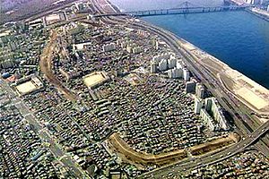
| 풍납토성 | |
|---|---|

| |
| 종목 | 사적 제11호 |
| 위치 | 서울특별시 송파구 풍납동,73-1 |
| 시대 | 백제 |
| 면적 | 383,621.3㎡ |
| 둘레 | 잔존 길이 약 2.7km |